University of Redlands
Departmental Honors is awarded to outstanding students who have a minimum GPA of 3.6 and complete an independent, original research project.

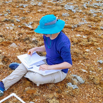
Montane meadows are highly accredited for providing ecosystem services such as water filtration, biodiversity, flood prevention and water storage. Understanding montane meadow ecosystems and their ability to withstand future changes in climate requires detailed knowledge about the hydrology (groundwater) that supports them. Here, I investigate the impact of extreme drought on the overall hydrologic health of two montane meadows in the San Bernardino National Forest. Using data from a dense piezometer network (24 wells installed), I calculate changes in water table depth from 2015 through 2025, to understand how these meadows recover from severe drought and summertime temperatures. By integrating precipitation, temperature, relative humidity, solar radiation, and real-time measurements at the study site, I assess the recovery of these meadows from the 2012-2019 California drought and the impact that sustained lack of precipitation has on these fragile ecosystems. With continued monitoring of the meadow’s water table and through the use of various models and projections I hope to be able to gain a more in depth understanding of the ecosystem’s behavior over time.

Habitat preference, distribution, and daily activity of black bears (Ursus americanus) in the Bearpaw Reserve within the San Bernardino National Forest was studied using camera trap data collected between 2018 and 2021. Variables such as elevation, diameter at breast height, canopy height and cover, ground cover, slope, and basal area were measured to determine what variables were most important to bear distribution. Mountain lions (Puma concolor) and mule deer (Odocoileus hemionus) in the Bearpaw Reserve were also tracked to determine how predation by bears and competition with other species affect distribution and behavior of black bears. Another topic surrounding black bear distribution that has been less studied is the impact of wildfires. Few definite conclusions have been made about the impact of disturbances on bears in prior studies. The El Dorado Fire in fall of 2020 greatly impacted the areas in and around Bearpaw. Data collected before and after this fire were analyzed to determine how this event influenced black bears, as well as other species in Bearpaw. Data was analyzed using maps in ArcGIS Online and statistical tests to find trends in the distribution of species in Bearpaw. It was found that diameter at breast height, basal area, and canopy cover were the most significant habitat variables related to black bear distribution. It was also found that bears overlapped areas with deer more than they did with mountain lions and were active at different parts of the day.
Pebble plains are a rare and unique plant habitat, limited to the San Bernardino Mountains in Southern California. However, their habitats have been fragmented and degraded from foot traffic, land development, off highway vehicle use, and other human disturbances. The response of pebble plains species to these disturbances have not been systematically investigated, despite the advantage it may have in pebble plains habitat management (USDA Forest Service, 2002). To determine the response of pebble plains species to disturbance, monitoring of percent frequency and cover was conducted for 11 species at the disturbed and fragmented “De-veg” pebble plains and were compared to control values at the relatively undisturbed Sawmill pebble plain. It was hypothesized that pebble plains species can completely recolonize disturbed areas, which would be evident if there were minimal differences in frequency and cover values from the control Sawmill values. The collected data suggests that none of the species have completely recovered in areas of disturbance. However, there was evidence of recolonization in areas that were once completely de-vegetated, especially by the species Eriogonum kennedyi. With proper habitat management, it is expected that frequency and cover for pebble plains species will eventually reach the control values.


The ubiquity of microplastic particles in the environment is causing irreversible ecological damage to organisms and threatening human health on a global scale. It is not fully known how microplastics react in the environment, but it is hypothesized that their combined sorption with other pathogens, such as 4-nonlyphenol, a persistent organic pollutant (POP) and endocrine disruptor, amplifies the ecotoxicological effects of microplastics in marine organisms and humans. The combined relationship between microplastics and sorbed 4-nonylphenol – regarding their partitioning abilities, long-range atmospheric transport, and deposition in snow and glaciers – has never been explored. Ice core sample from three glaciers: Palisades, Middle Palisades, and Dinwoody Glaciers in the Sierra Nevada and Rocky Mountains were tested for microplastic particles and compared to known 4-nonylphenol concentrations in the same mountain ranges. Microplastic particles were characterized by filtering snow samples and analyzed using fluorescence microscopy. In total, 4,467 total microplastic fibers and particles were found across all glaciers with an average 4-nonylphenol concentration of .0640 mg/L. Since glaciers provide proxy data for physical airborne characteristics, these values demonstrate that both glaciers store a significant amount of microplastic particles and 4-nonlyphenol that will be reintroduced into the environment as the climate continues to warm.

4-nonylphenol (4-NP) is a persistent organic pollutant (POP). And endocrine disruptor which acts as an estrogen mimic. It is a breakdown product of nonylphenol polyethoxylates (NPEs), a class of compounds used as surfactants in California’s Central Valley and other highly agricultural areas. Once sprayed, 4-NP binds to particulate matter, is carried via long-range atmospheric transport, and deposited into the environment. As 4-NP is a known carcinogen and endocrine disruptor in humans and wildlife, understanding how 4-NP adsorbs and desorbs from particulates in the environment would be extremely helpful to quantify the amount in our water. This paper details a method by which the partition coefficient (KP) of 4-NP was found in a range of environmental conditions, and how it was used to find the Gibbs Free Energy (∆G) of adsorption of 4-NP from soil particulates. This was done by dosing four soil types of varying carbon content with a known concentration of 4-NP and observing the concentration which 4-NP desorbed into four water samples of varying ionic strengths. This experimental data allowed for the empirical determination of the ∆G of adsorption, which suggests that desorption becomes more thermodynamically unfavorable as ionic strengths and organic carbon content increases, and implies that soils and sediments in marine environments will act as sinks for 4-NP.

West of the Sierra Nevada Mountain Range, located in southwestern California lives an endemic and very iconic North American Mojave Desert species, the Western Joshua Tree (Yucca brevifolia). The Western Joshua Tree (WJT) is a keystone species in a healthy Mojave Desert ecosystem and provides environmental resources and shelter to species located within it. Over the last 40 years wildfires have been recorded to be one of the most negative factors impacting the WJT by having a high mortality rate in wildfire events and destroying their reproduction efforts. This study was conducted to contribute to a peer reviewed status report to list the WJT as a threatened species under the California Endangered Species Act (CESA) of 1970 with the California Department of Fish and Wildlife. All data used in this study was spatially analyzed using ArcGIS Pro ESRI-supported shapefiles illustrating 6.62 % (271,065 acres) of the WJT habitat has been burned over the past four decades. This study found that in Southern California the WJT habitat is being burned at an increasing rate and is being negatively impacted by California wildfires. Although there are conservation efforts to protect the WJT through national parks, national forests, and local NGO’s, the act of utilizing the CESA and listing the WJT as a threatened species must be enacted to ensure survivorship.

In previous studies, exposure to poor air quality has been documented as positively correlated to respiratory and cardiovascular impairments. Consequently, the correlation of poor air quality and vulnerable public health has been documented for decades. In Southern California, metropolitan areas such as San Bernardino and Riverside counties have the worst recorded air quality in the nation for the past several years. Rapid urban and industrial development has bolstered the logistics and shipping industry within the region, but perhaps at the costs of residents’ health. There is also evidence that pollution burden and proximity to pollution sources are correlated with race. Based off the previous literature, the main question this study explores is: Are race and public health correlated with distance from pollution sources, such as freeways and warehouses? Although the initial hypotheses expected to find negative correlations between race and health variables with increasing distance from pollution sources, the results of this study were found to be incongruent. Despite these results, this study was designed with current events in mind, and highlights the importance of an Indirect Source Rule to be enforced by the South Coast Air Quality Management District, as well as a more holistic view when addressing environmental inequity and justice.

Anthropogenic climate change is already impacting ecological, social, and economic systems around the world and there is an increasing likelihood of irreversible damage regardless of mitigation efforts before the end of the 21st century. Given the projected changes in precipitation patterns and warmer average temperatures, winter snowpack in mountains around the world is likely to decline. This not only threatens ecosystems and human communities that rely on snowpack for year-round water supply, but also the viability of the ski industry, a major contributor to U.S. state and national economies. Prior studies have assessed the potential impacts of climate change under multiple projected emissions scenarios in Colorado, but to date no such assessment has been made for the mountains of southern California within the context of the ski industry. This study aims to address this gap by using a water-balance model with observational climatological data and data from General Circulation Models to model projected impacts on snowmelt rate in the area around Big Bear Lake, CA. Big Bear Lake is located in the San Bernardino Mountains in southern California. Bordering this lake are two ski resorts; Bear Mountain and Snow Summit. The results of this study find that there has been an ahistorical increase in the rate of snowmelt in the study area, in that we are already seeing more inches of snowmelt per season, on average, during the months when there is measurable snowpack on the ground. In addition, the study finds that snowmelt rate in the study area could decrease under RCP 4.5 and increase under RCP 8.5 over the remainder of the century. Understanding how climate change may affect future snowpack is critical for the ski industry and water resource managers alike to make the appropriate adaptations to preserve the industry and ensure water security in California for the remainder of the century.